The Old Road Beneath the New Route
Trace how an old road survives beneath a new route by comparing maps, names and ground clues, and separate visible evidence from local tradition.
Where did the old road go when the county route was straightened? To trace an old road beneath a new route, start with the bend, lane or boundary that remains, then separate what maps and ground show from what later names and stories suggest.
Say a walker wants to understand why a minor road called Mill Lane curves away from the newer A-road, then resumes beyond a housing estate. A local account calls it an ancient packhorse road. That may be possible, but the name and story do not establish it. The useful questions are where people travelled, how the line changed, and what evidence supports each answer.
What counts as the same route?
A route is not simply a strip of paving. It is a corridor of movement that may narrow to a track, widen into a road or divide among parallel lines. Its course can shift towards a bridge, away from wet ground, or around a growing settlement. A modern road may inherit part of an older alignment without being the same road in every practical or legal sense.
In county geography, a route can connect settlements and markets while its surface, name, ownership and status change. “The old road” might mean a visible lane, a disused track, a remembered way or a line on a map. Be clear about which one you mean before tracing its history.
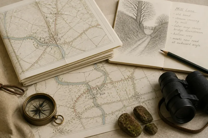
Imagine an early county map showing a road curving past a mill and crossing a stream. A later map shows a straighter road on the mill’s far side, while a short lane keeps the older curve. This suggests a change in alignment, but does not establish how long the route existed before the earlier map. Maps record what their makers chose to show; an empty space is not proof that no path existed.
How can maps reveal an old road beneath a new route?
Compare maps using durable reference points rather than labels alone. A church, stream crossing, mill site, bridge, field corner or junction can help match one section to another. If an older map shows a road bending around a place and a later one shows it running past, that may indicate realignment. The reason needs separate evidence.
For a desk-based comparison, set the earliest useful county or parish map beside later Ordnance Survey mapping. Historic maps may be consulted through county archives, local studies libraries and online map collections. Check each map’s date, scale and purpose. Estate plans may record access roads closely but omit public routes elsewhere; small-scale maps can simplify bends; later maps may retain a name after the route has shifted.
Place names can help locate an old alignment, but handle them cautiously. “Old Road”, “Causeway” or “Packhorse Lane” might preserve a useful local distinction. They might also be later labels inspired by the lane’s appearance or a memorable account. A name points to a question; it does not settle the answer.
In the invented Mill Lane case, the walker notes that one map marks the stream crossing beside the mill, while a later map places a bridge farther downstream. The old bend remains as a narrow lane. A changed crossing is plausible, but the maps alone do not establish who arranged the work, when it happened or whether the whole route served packhorses.
What can the ground add?
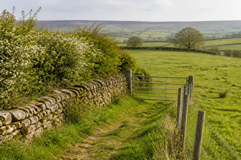
A careful walk can show whether mapped lines correspond to features on the ground. Look for a shallow hollow worn into a slope, a raised causeway through damp ground, a surviving stone bridge or a lane meeting the newer road at an awkward angle. A straight hedge or property edge may echo an earlier corridor, though it may have another origin. One clue calls for comparison, not a verdict.
Notice where the old line approaches water, a steep gradient or a settlement edge. A route that keeps to firmer ground may help explain a bend that looks unnecessary on a modern map. A diversion might instead lead towards a newer bridge or away from a growing settlement. The landscape can make explanations more plausible, but rarely supplies a date by itself.
Do not treat a change of surface as proof that the route changed. A lane may have been metalled, widened or drained along the same course; a new-looking road may occupy an older corridor. Ground features have limits too: a bank might be a field edge, a former road margin or a result of drainage. Record what is visible and where, then compare it with maps and documents.
Access matters. A footpath shown on a map does not necessarily permit crossing adjoining land, and an apparent track may be private. Keep to public rights of way and road surfaces, and check local access information if the status is uncertain. The landscape is there to be read, not to make a boundary optional.
Why do route names and local stories change?
Names often attach to the stretch people use most, not to the whole historic corridor. One section might be Mill Lane, another Church Road, while the connecting part takes a county road number. When a road is diverted, its old name may remain on a side lane or move to the newer line. A name may describe local memory better than continuous geography.
Stories can preserve a real feature while adding details that are harder to verify. A packhorse account might reflect a long-standing association between the lane and carrying goods, without identifying its first use or original purpose. A “Roman road” label can likewise be a local explanation for a straight or raised line. Neither story should be dismissed automatically; neither should be presented as fact without supporting evidence.
The route’s history and its later story answer different questions. The history asks what maps, records and physical traces can establish about its course, use and alteration. The story asks how residents came to explain or remember the road. That tradition belongs to the place’s cultural geography even if its account of the route’s origins remains uncertain.
In the invented Mill Lane case, the walker finds no document confirming a packhorse road. An old map shows the curve, and a local booklet repeats the account without naming its source. A careful description would say the lane preserves part of an earlier mapped alignment, while local tradition associates it with packhorses. The map and tradition each remain visible, with neither made to stand in for the other.
Which records can help date a diversion?
Maps show how a route was represented; other records may explain why it changed. County highway minutes, parish records, bridge accounts, turnpike documents, estate papers and road-maintenance records can mention repairs, new crossings or proposed alterations. County archives and local studies services can advise on catalogues and relevant record groups. Searches may be complicated by gaps, changed administrative boundaries or records that describe a road without using its present name.
Search for nearby places and features as well as the lane’s name. A bridge may appear under the name of a stream, mill or parish. Spellings change, and administrative labels shift. A record about a new bridge supports a connection only if its location and context fit the mapped route.
For the invented case, suppose a parish record mentions repairs to a bridge downstream of the mill, and a later map shows the straighter road crossing there. The walker can describe a likely relationship between the bridge and the altered alignment. Unless the record explicitly links them, it would be safer not to claim that the bridge alone caused the diversion. The evidence narrows the explanation without filling in what the record leaves unsaid.
What should you ask when tracing an old road?
Does an old name prove an old route?
No. A name may preserve local memory, describe a visible feature or arise later from an interpretation of the landscape. Compare it with maps and other evidence before treating it as proof of age.
Can a new road follow an older line?
Yes. A newer surface or official classification can occupy an established corridor, while nearby bends and lanes retain parts of an earlier alignment. Compare junctions, crossings and stable landmarks to see what changed.
What might a map leave out?
A map may omit minor tracks, simplify a curve or reflect a particular administrative purpose. Check its date and scale, compare more than one map where possible, and do not treat an unmarked line as proof that no route existed.
How should you describe an uncertain local story?
Attribute it as a tradition, then state separately what the available evidence supports. This keeps the story part of the place’s history without presenting its explanation as established fact.
How should the route be described afterwards?
For the invented Mill Lane, a sound account might read: “The surviving lane follows part of the curve shown on an earlier county map. Later mapping shows the main road using a straighter line and a crossing farther downstream. Local tradition calls the older line a packhorse road, though the records considered here do not confirm that origin.” This describes the evidence and marks its limits.
Keep separate notes for what maps, records and ground features show, and for what people call the road or say about it. A label can be useful evidence of local memory, but it cannot establish an alignment, date or use on its own. That distinction makes an account easier to revise if better records turn up.