Why Rivers Make Such Persistent County Borders
Why rivers make persistent county borders: learn to read where a boundary follows a channel, where it departs, and when a map cannot settle the legal line.
Why do rivers make such persistent county borders? On many county maps, the boundary appears to track a channel for a time, then turn inland. The river is straightforward to spot; the precise line it represents may not be. Reading both the watercourse and the map’s purpose explains why a river can remain a useful landmark without settling every boundary question.
Why do rivers make memorable county borders?
A river gives a boundary a recognisable course through the landscape. Instead of following a sequence of field edges that may be difficult to identify at map scale, the line can be described in relation to a named watercourse. That makes the broad geography easier to picture and discuss.
But a river is not simply a dividing ditch. It can carry boats, support bridges and draw settlements to both banks. The same watercourse may separate counties on a map while linking their residents through crossings and shared routes. Its usefulness as a border comes from its visibility, not from a rule that every county boundary must follow water.
A river valley can remain a prominent feature even as its channel shifts, branches or floods. That persistence helps explain why a boundary may still be associated with a river when the water no longer sits exactly where an old map suggests. It is rather like a street address: useful for locating a place, but not a complete account of every detail on the ground.
What does a boundary “along the river” mean?
A county map may draw the line near the centre of a blue channel, but the illustration alone does not establish whether the formal boundary follows the centre, one bank, a surveyed line or another defined feature. Small-scale maps also simplify bends, islands and side channels to keep the overall pattern legible.
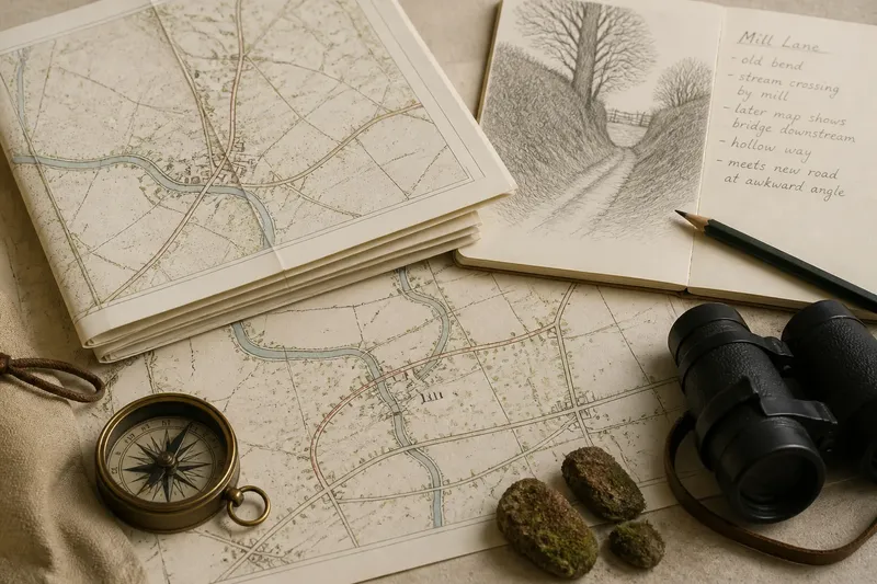
Different maps answer different questions. A county map shows the broad relationship between river and boundary. A more detailed map or a formal boundary description may be needed to identify the line being represented. Differences in appearance do not necessarily mean that one map is useless; they may reflect scale, purpose or the source used.
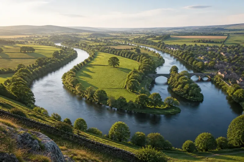
Where a river divides into channels, the phrase “along the river” becomes less precise. An island may lie between branches, and a bridge may cross the water without defining the county line. Treat the river as a clue, not as a replacement for the record that defines the boundary.
Can a river change course while the county line stays put?
Watercourses can alter their banks through erosion and deposition. Flooding may reshape a channel, while gradual change can shift a bend across a floodplain. A boundary once described by reference to the river may therefore appear away from the present channel.
The opposite arrangement is also possible: the boundary description may link the line to a watercourse that changes over time. Which applies depends on the relevant wording and legal context. There is no universal rule that every county boundary either moves with the river or stays fixed when the river moves.
An aerial image shows the channel as it appears now, not necessarily the rule used to define the boundary. For a general geography question, a county map may be adequate. For property, planning or formal jurisdiction matters, consult the relevant authority or a qualified professional rather than inferring legal status from a riverbank.
What should you check when a river border is unclear?
Does the county line always follow the middle of the river?
No. A map may place the line there for clarity, while the formal description refers to a bank, channel or separately defined line. Check the map’s scale and purpose before treating its drawn position as exact.
Which channel matters where a river splits?
A branching river can make it unclear which stretch a map means, particularly around islands and side channels. Compare a detailed map with the relevant boundary record rather than choosing the widest-looking branch by eye.
Can the river move without the county border moving?
Yes, depending on how the boundary was defined. A fixed line may remain in place as the channel shifts, while a description tied to the watercourse may call for a different interpretation.
Why does a boundary leave the river on a map?
The river may cease to be the relevant landmark at a junction, or the map may simplify a bend or crossing. Check a more detailed map before deciding that a sharp turn depicts an exact legal feature.
How can you compare a river with the county boundary?
Start with a county map to find a stretch where the boundary appears to follow a river. Compare that view with a more detailed map from an appropriate mapping service, then look for bends, islands, tributaries, bridges and points where the boundary seems to depart from the channel. Check the legend and any available boundary description to establish what kind of line the map depicts.
- River and county names: Check that both are identified on the county map. If either is unclear, then consult a more detailed map before describing the stretch; otherwise, note the names and continue.
- Map scale: Check whether the bend or channel is shown in enough detail. If it is simplified, then treat the apparent alignment as approximate; otherwise, compare the mapped line with the watercourse.
- Channels and islands: Check for branches, islands or side channels. If more than one plausible channel appears, then leave the exact route unresolved pending a boundary record; otherwise, note which mapped channel the line appears to follow.
- Crossings and tributaries: Check where bridges or smaller streams meet the river. If the boundary turns or crosses at one of these points, then compare another map rather than assuming the crossing defines it; otherwise, record the visible relationship.
- Map legend: Check whether the line represents a county or another administrative boundary. If the legend does not identify it, then find a suitable boundary map; otherwise, use the line only for the purpose the legend supports.
- Formal description: Check whether an authoritative boundary description is available. If it does not clarify the channel or line, then state that the exact position remains uncertain; otherwise, describe the relationship using the terms in that record.
- Final wording: Check that your description does not claim greater precision than the maps provide. If the line is clear only at a broad scale, then say it appears to follow the river; otherwise, identify the specific departure or ambiguity shown.
Say you are comparing a county map with a detailed map of a river bend beside an island. The county map places the border on the river, while the detailed map shows two channels and a boundary line that appears to favour one branch. You note the two channels, check the map legend, and look for an available boundary description. If that record does not identify the intended branch, your result is a clear account of what the maps show and an unresolved exact position, rather than a guess presented as fact.
What can a river boundary tell you about county character?
A river border shows how a county is represented as well as where its edge is drawn. It can make one part of the boundary easy to trace while leaving bridges, riverbank settlements and routes shared across the water. Elsewhere, the same river may run through a county rather than mark its edge.
When describing a county, say that its boundary follows a river where the map supports that reading, and name departures or ambiguities where they matter. Why rivers make persistent county borders is partly a matter of clear geography, but the persistence belongs to the defined line as much as to the changing channel. If the distinction matters beyond a general description, consult the boundary record before treating the river as the border itself.