The Village-at-the-Crossroads Story Is Not the Whole Story
Why a village at a crossroads may owe its location to more than intersecting roads, and how to read its setting without forcing a neat origin story.
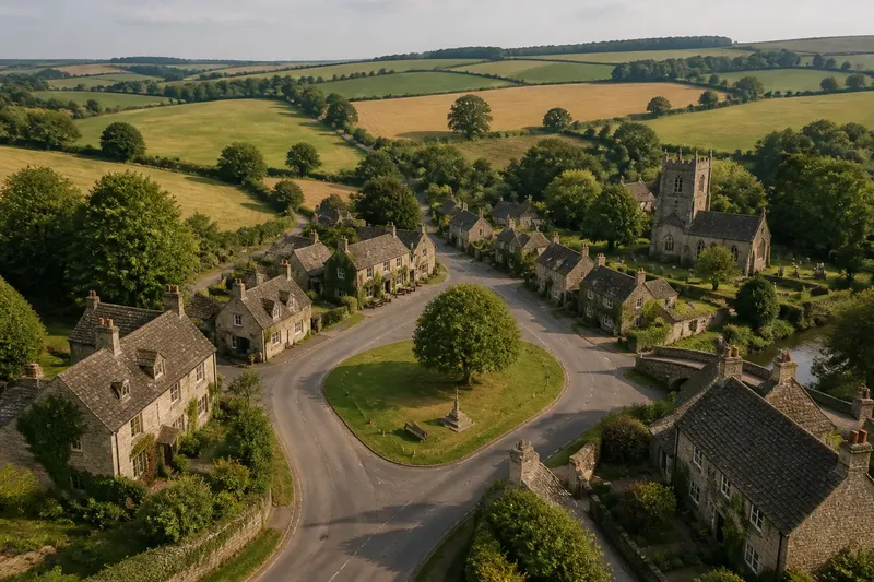
Why did this village grow here? The crossroads explanation is tempting: two roads meet, travellers stop, houses gather, and a settlement appears. But a crossroads can explain why a place became convenient without explaining why people first settled there, or why it stayed put. To read a village site more carefully, separate the clues instead of asking one junction to do all the work.
Why does the crossroads story feel so convincing?
A junction is visible on a map and easy to describe on a walk. It gives a village a centre, often with a green, a pub, a church or a cluster of shops nearby. The arrangement seems to tell its own story: traffic arrives from several directions, and a settlement forms where routes meet.
That account may be partly right. A junction can bring passing trade, make services easier to reach and encourage buildings along the roads. Yet a map shows the routes that exist now, not necessarily the tracks or lanes used when the settlement began. Nor does a crossing on its own tell us whether the first houses were built for travellers, farm workers, a religious community or some other local need.
The first problem, then, is treating a clear pattern as a complete cause. A crossroads is evidence of connected movement; it is not a birth certificate. Keep it as one clue, and ask what other conditions made the location useful or habitable.
What if the roads came after the settlement?
Roads change. A route may be straightened, diverted around a difficult slope, widened or replaced by a road serving different destinations. A lane that now meets another at the village centre may once have run past its edge, while a footpath or track no longer visible on a road map may have linked the earliest buildings to nearby fields.
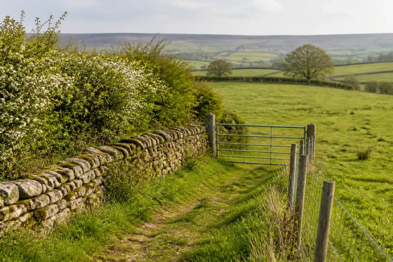
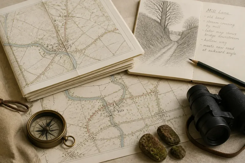
This is a common source of tidy but mistaken explanations: the present-day junction is projected backwards. Compare older maps, where available, and look for names such as “lane”, “green way” or “hollow way” in local records. On the ground, an abrupt bend, a lane that narrows beyond the houses or a path continuing behind a hedge can suggest that today’s road pattern is not the whole route history. These clues prompt questions; they do not establish a date or a single sequence by themselves.
Imagine a village whose central junction appears on a modern map, but an older map shows one road passing outside the built-up area. If the church and oldest-looking house group sit away from the junction, the useful next move is to compare their positions with historic route lines and field access. The observable result may be a more complicated map of connections, rather than a single crossing that explains everything.
Could the land have limited where people could build?
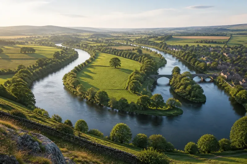
A route is useful only if the surrounding ground can support the activity it serves. A village may sit on a slight rise above wet ground, beside a spring, near a manageable river crossing or at the edge of better-drained farmland. These features can affect where houses, paths and fields make sense, even if a junction later gives the settlement its most recognisable shape.
Look for small changes in elevation, drainage ditches, streams and the transition between soil types. A church or older building group on firmer ground may be more revealing than the busiest present-day road. Equally, a settlement beside water is not automatically a water-dependent settlement: people may have valued dry ground, access to fields or a convenient route more than the stream itself.
Use a detailed topographic map alongside a walk, rather than relying on a road map alone. Notice where the ground becomes muddy, where a slope eases, and where paths skirt a wet hollow. The comparison is rather like reading a folded map: the crossing is one crease, but the shape of the land determines what can lie around it.
Which local needs might the junction have served?
Villages are not simply traffic accidents with cottages. Their location can reflect farming, estate organisation, worship, access to common land, a mill or a place to cross water. A crossroads may have helped these activities meet, but it may also have become prominent only after a settlement already had a reason to exist.
Look for the relationship between the village and its working landscape. Older farmsteads may stand near field entrances rather than the junction; a church may occupy a separate rise; a former mill site may lie where a stream could provide power. A green or common can point to shared use of land, while a large house or estate boundary may have influenced where workers’ homes clustered. None of these features proves a founding story in isolation. Their value lies in showing what the settlement could connect to and support.
For a careful account, distinguish “the village grew around the crossing” from “the crossing helped the village grow”. The first claims a specific origin. The second describes a plausible role that can fit alongside farming, water, worship and landholding without pretending the evidence is complete.
How can you tell a village centre from its earliest core?
The centre people use today may not be the oldest part. Shops, a bus stop, a village hall or a prominent pub can make one junction feel central, while the earliest surviving buildings lie along a quieter lane. A settlement can also have several small clusters that later joined as roads, services and housing changed.
Compare building groups rather than choosing the most obvious landmark. Note where older farm buildings, the church, cottages and later housing stand in relation to fields and routes. Check whether the village has a green or a long, stretched street plan. A compact cluster near one crossing suggests a different pattern from a settlement strung along a road, but neither shape supplies its own full history.
Where the evidence is uncertain, describe the pattern precisely: “The church and older farmsteads lie north of the present junction” is more useful than calling the junction the village’s original heart. Local history records and historic maps may add context, but a cautious description remains sound if they do not settle the question.
What questions help untangle the origin story?
How do I know whether the crossroads is old?
Compare maps from different periods and look for changes in the road network, building clusters and lane names. A junction that appears late in the map sequence may be important to the village’s later growth without explaining its first settlement.
Does a church near the junction prove the village began there?
No. A church can mark a focus of community life, but its position does not by itself date nearby roads or houses. Compare it with older farmsteads, the landform and surviving route patterns before describing it as the settlement’s starting point.
What if local accounts disagree about the village’s origin?
Keep the competing explanations distinct and identify what each one can actually account for. One may explain the market or road traffic, while another better fits the church, fields or older building cluster.
Which maps and records are most useful?
Historic Ordnance Survey maps, tithe maps, estate maps and parish records can reveal different parts of the picture. Their coverage and terminology vary, so compare sources rather than treating one map as a complete record.
What should you try before repeating the neat version?
When a crossroads explanation seems to fit, work through the following checks in order. The aim is not to replace a simple story with a more elaborate one for its own sake. It is to see whether the evidence supports the claim being made.
- Locate the oldest visible building groups. Note whether they sit at the junction, beside a church, along a lane or near a farm entrance. If they cluster elsewhere, avoid calling the crossroads the village’s original centre without further evidence.
- Compare route patterns across maps. Check whether roads meet in the same place over time. If alignments shift, describe the junction as part of the village’s later development unless records support an earlier role.
- Read the land around the settlement. Mark streams, slopes, wet hollows and firmer ground. If buildings favour a particular terrace or rise, include that constraint in the explanation rather than making the road network do all the work.
- Look for links to fields and shared resources. Trace paths to farms, commons, water or a mill site. If those connections converge on the settlement independently of the main roads, they may help explain why people lived there.
- Separate evidence from inference. Record what a map or building shows, then state what it might mean. If the inference depends on an uncertain date or missing route, make that uncertainty plain.
- Check local records where the distinction matters. Parish histories, estate papers and archival maps may clarify changes in land use or road alignment. Where names, boundaries or ownership affect the interpretation, follow the source’s own definitions and seek knowledgeable local or archival help if needed.
How should you describe a village whose origins remain uncertain?
A good account can be specific without claiming more than the evidence allows. Say that a village occupies a useful meeting point, then add what else shapes its position: higher ground, access to fields, a church, a stream crossing or a link between neighbouring settlements. Make clear whether you are describing a visible relationship or proposing an origin.
The crossroads may still matter. It can explain where later shops gathered, why roads remain busy or how the village connects to the surrounding county. But a settlement’s character often comes from the overlap between routes, land and local needs, not from a single dramatic meeting of lanes. The most reliable village-at-the-crossroads story is the one that leaves room for what the map does not show.